Thursday 28 March 2013

SOUTH ASIA


SOUTH ASIA MAP


List of South Asia Countries :


  • Afghanistan
  • Bangladesh
  • Bhutan
  • India
  • Myanmar
  • Maldives
  • Nepal
  • Pakistan
  • Sri Lanka


  • Geographical Physical Regions of South Asia :


    While South Asia had never been a coherent geopolitical region, it has a distinct geographical identity.The boundaries of South Asia vary based on how the region is defined. South Asia's northern, eastern, and western boundaries vary based on definitions used, while the Indian Oceanis the southern periphery. Most of this region rests on the Indian Plate and is isolated from the rest of Asia by mountain barriers.The Indian Plate includes most of South Asia, forming a land mass which extends from the Himalayas into a portion of the basin under the Indian Ocean, including parts of South China and Eastern Indonesia, as well as Kuen Lun and Karakoramranges, and extending up to but not including LadakhKohistan, the Hindu Kush range and Balochistan.It may be noted that geophysically the Yarlung Tsangpo River river in Tibet is situated at the outside of the border of the Subcontinental structure, while the Pamir Mountains in Tajikistan are situated inside that border.
    Much of the region comprises a peninsula in south-central Asia, rather resembling a diamond which is delineated by the Himalayas on the north, the Hindu Kush in the west, and the Arakanese in the east,and which extends southward into the Indian Ocean with the Arabian Sea to the southwest and the Bay of Bengal to the southeast.
    Per the UN, the wider subregion's northern frontier is the Himalayas and southerly post-Soviet states of Central Asia (TajikistanUzbekistan, andTurkmenistan, bordering northern Afghanistan and Iran), its western boundary is the westerly border of Iran (with AzerbaijanArmeniaTurkey, andIraq), and its eastern boundary is the westerly border of Burma (with India and Bangladesh).
    Most of this region is a subcontinent resting on the Indian Plate (the northerly portion of the Indo-Australian Plate) separated from the rest of the Eurasian Plate. It was once a small continent before colliding with the Eurasian Plate about 50-55 million years ago and giving birth to theHimalayan range and the Tibetan plateau. It is the peninsular region south of the Himalayas and Kuen Lun mountain ranges and east of the Indus River and the Iranian Plateau, extending southward into the Indian Ocean between the Arabian Sea (to the southwest) and the Bay of Bengal (to the southeast).
    The region is home to a variety of geographical features, such as glaciersrainforestsvalleysdeserts, and grasslands that are typical of much larger continents. It is surrounded by three water bodies — the Bay of Bengal, the Indian Ocean and the Arabian Sea. The climate of this vast region varies considerably from area to area from tropical monsoon in the south to temperate in the north. The variety is influenced by not only the altitude, but also by factors such as proximity to the sea coast and the seasonal impact of the monsoons.


    Climate of The South Asia :

    Southern parts are mostly hot in summers and receive rain during monsoon period(s). The northern belt of Indo-Gangetic plains also is hot in summer, but cooler in winter. The mountainous north is colder and receives snowfall at higher altitudes of Himalyan ranges.

    As the Himalayas block the north-Asian bitter cold winds, the temperatures are considerably moderate in the plains down below. For most part, the climate of the region is called the Monsoon climate, which keeps the region humid during summer and dry during winter, and favors the cultivation of jutetearice, and various vegetables in this region.

    The Importance of Geographical Physical Regions and Climate for South Asia Tourism :

    • for the tourist attraction
    • can increase the loca ecnomies
    • can rate the tourism level
    INDIA


    demography india

    With 1,210,193,422 residents reported in the 2011 provisional census,India is the world's second-most populous country. Its population grew at 1.76% per annum during 2001–2011,down from 2.13% per annum in the previous decade (1991–2001).The human sex ratio, according to the 2011 census, is 940 females per 1,000 males.The median age was 24.9 in the 2001 census.The first post-colonial census, conducted in 1951, counted 361.1 million people.Medical advances made in the last 50 years as well as increased agricultural productivity brought about by the "Green Revolution" have caused India's population to grow rapidly.India continues to face several public health-related challenges.According to the World Health Organisation, 900,000 Indians die each year from drinking contaminated water or breathing polluted air.There are around 50 physicians per 100,000 Indians.The number of Indians living in urban areas has grown by 31.2% between 1991 and 2001.Yet, in 2001, over 70% lived in rural areas.According to the 2001 census, there are 27 million-plus cities in India;among them DelhiMumbaiKolkata,ChennaiBangaloreHyderabad and Ahmedabad are the most populous metropolitan areas. The literacy rate in 2011 was 74.04%: 65.46% among females and 82.14% among males.Kerala is the most literate state;Bihar the least.

    India is home to two major language familiesIndo-Aryan (spoken by about 74% of the population) and Dravidian (24%). Other languages spoken in India come from the Austroasiatic and Tibeto-Burman language families. India has no national language.Hindi, with the largest number of speakers, is the official language of the government.English is used extensively in business and administration and has the status of a "subsidiary official language";it is important in education, especially as a medium of higher education. Each state and union territory has one or more official languages, and the constitution recognises in particular 21 "scheduled languages". The Constitution of India recognises 212 scheduled tribal groups which together constitute about 7.5% of the country's population.The 2001 census reported that Hinduism, with over 800 million adherents (80.5% of the population), was the largest religion in India; it is followed by Islam (13.4%), Christianity (2.3%), Sikhism (1.9%), Buddhism (0.8%), Jainism (0.4%), JudaismZoroastrianism, and the Bahá'í Faith.India has the world's largest Hindu, Sikh, Jain, Zoroastrian, and Bahá'í populations, and has the third-largest Muslim population and the largest Muslim population for a non-Muslim majority country.

    Culture


    Warli tribal painting by Jivya Soma Mashe from Thane, Maharashtra
    Indian cultural history spans more than 4,500 years.During the Vedic period (c. 1700–500 BCE), the foundations of Hindu philosophymythology, and literature were laid, and many beliefs and practices which still exist today, such as dhármakármayóga, and mokṣa, were established.India is notable for its religious diversity, with Hinduism, Sikhism, Islam, Christianity, and Jainism among the nation's major religions.The predominant religion, Hinduism, has been shaped by various historical schools of thought, including those of the Upanishads,the Yoga Sutras, the Bhaktimovement,and by Buddhist philosophy.

    Art and architecture

    Much of Indian architecture, including the Taj Mahal, other works of Mughal architecture, and South Indian architecture, blends ancient local traditions with imported styles.Vernacular architecture is also highly regional in it flavours. Vastu shastra, literally "science of construction" or "architecture" and ascribed to Mamuni Mayan,explores how the laws of nature affect human dwellings; it employs precise geometry and directional alignments to reflect perceived cosmic constructs.As applied in Hindu temple architecture, it is influenced by the Shilpa Shastras, a series of foundational texts whose basic mythological form is the Vastu-Purusha mandala, a square that embodied the "absolute".The Taj Mahal, built inAgra between 1631 and 1648 by orders of Emperor Shah Jahan in memory of his wife, has been described in the UNESCO World Heritage List as "the jewel of Muslim art in India and one of the universally admired masterpieces of the world's heritage."Indo-Saracenic Revival architecture, developed by the British in the late 19th century, drew on Indo-Islamic architecture.

    geography

    India comprises the bulk of the Indian subcontinent and lies atop the minor Indian tectonic plate, which in turn belongs to the Indo-Australian Plate.India's defining geological processes commenced 75 million years ago when the Indian subcontinent, then part of the southern supercontinentGondwana, began a north-eastward drift across the then-unformed Indian Ocean that lasted fifty million years.The subcontinent's subsequent collision with, and subduction under, the Eurasian Plate bore aloft the planet's highest mountains, the Himalayas. They abut India in the north and thenorth-east.In the former seabed immediately south of the emerging Himalayas, plate movement created a vast trough that has gradually filled with river-borne sediment;it now forms the Indo-Gangetic Plain.To the west lies the Thar Desert, which is cut off by the Aravalli Range.
    The original Indian plate survives as peninsular India, which is the oldest and geologically most stable part of India; it extends as far north as the Satpuraand Vindhya ranges in central India. These parallel chains run from the Arabian Sea coast in Gujarat in the west to the coal-rich Chota Nagpur Plateauin Jharkhand in the east.To the south, the remaining peninsular landmass, the Deccan Plateau, is flanked on the west and east by coastal ranges known as the Western and Eastern Ghats;the plateau contains the nation's oldest rock formations, some of them over one billion years old. Constituted in such fashion, India lies to the north of the equator between 6° 44' and 35° 30' north latitude and 68° 7' and 97° 25' east longitude.


    India's coastline measures 7,517 kilometres (4,700 mi) in length; of this distance, 5,423 kilometres (3,400 mi) belong to peninsular India and 2,094 kilometres (1,300 mi) to the Andaman, Nicobar, and Lakshadweep island chains.According to the Indian naval hydrographic charts, the mainland coastline consists of the following: 43% sandy beaches; 11% rocky shores, including cliffs; and 46% mudflats or marshy shores.
    Major Himalayan-origin rivers that substantially flow through India include the Ganges and the Brahmaputra, both of which drain into the Bay of Bengal.Important tributaries of the Ganges include the Yamuna and the Kosi; the latter's extremely low gradient often leads to severe floods and course changes.[119]Major peninsular rivers, whose steeper gradients prevent their waters from flooding, include the Godavari, the Mahanadi, the Kaveri, and the Krishna, which also drain into the Bay of Bengal;and the Narmada and the Tapti, which drain into the Arabian Sea.Coastal features include the marshy Rann of Kutch of western India and the alluvial Sundarbans delta of eastern India; the latter is shared with Bangladesh.India has two archipelagos: the Lakshadweep, coral atolls off India's south-western coast; and the Andaman and Nicobar Islands, a volcanic chain in the Andaman Sea.
    The Indian climate is strongly influenced by the Himalayas and the Thar Desert, both of which drive the economically and culturally pivotal summer and wintermonsoons.The Himalayas prevent cold Central Asian katabatic winds from blowing in, keeping the bulk of the Indian subcontinent warmer than most locations at similar latitudes. The Thar Desert plays a crucial role in attracting the moisture-laden south-west summer monsoon winds that, between June and October, provide the majority of India's rainfall.Four major climatic groupings predominate in India: tropical wettropical drysubtropical humid, and montane

    natural resources india
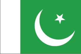
    India's major mineral resources include Coal (fourth-largest reserves in the world), Iron ore, ManganeseMicaBauxiteTitanium ore, ChromiteNatural gasDiamondsPetroleumLimestone andThorium (world's largest along Tamil Nadus shores). India's oil reserves, found in Bombay High off the coast of MaharashtraGujaratRajasthan and in eastern Assam meet 25% of the country's demand.

    PAKISTAN


    climate

    Pakistan covers an area of 796,095 km2 (307,374 sq mi), approximately equal to the combined land areas of France and the United Kingdom. It is the36th largest nation by total area, although this ranking varies depending on how the disputed territory of Kashmir is counted. Pakistan has a 1,046 km (650 mi) coastline along the Arabian Sea and the Gulf of Oman in the south and land borders of 6,774 km (4,209 mi) in total: 2,430 km (1,510 mi) with Afghanistan, 523 km (325 mi) with China, 2,912 km (1,809 mi) with India and 909 km (565 mi) with Iran. It shares a marine border with Oman,and is separated from Tajikistan by the cold, narrow Wakhan Corridor.Pakistan occupies a geopolitically important location at the crossroads of South Asia, the Middle East and Central Asia.
    Geologically, Pakistan overlaps the Indian tectonic plate in its Sindh and Punjab provinces; Balochistan and most of Khyber Pakhtunkhwa are within theEurasian plate, mainly on the Iranian plateau. Gilgit–Baltistan and Azad Kashmir lie along the edge of the Indian plate and hence are prone to violent earthquakes. Ranging from the coastal areas of the south to the glaciated mountains of the north, Pakistan's landscapes vary from plains to deserts, forests, hills and plateaus.


    Pakistan is divided into three major geographic areas: the northern highlands, the Indus River plain and the Balochistan Plateau. The northern highlands contain the KarakoramHindu Kush and Pamir mountain ranges (see mountains of Pakistan), which contain some of the world's highest peaks, including five of the fourteen eight-thousanders (mountain peaks over 8,000 metres or 26,250 feet), which attract adventurers and mountaineers from all over the world, notably K2 (8,611 m or 28,251 ft) and Nanga Parbat (8,126 m or 26,660 ft).The Balochistan Plateau lies in the west and the Thar Desert in the east. The 1,609 km (1,000 mi) Indus River and its tributaries flow through the country from the Kashmir region to the Arabian Sea. There is an expanse of alluvial plains along it in Punjab and Sindh.
    The climate varies from tropical to temperate, with arid conditions in the coastal south. There is a monsoon season with frequent flooding due to heavy rainfall, and a dry season with significantly less rainfall or none at all. There are four distinct seasons: a cool, dry winter from December through February; a hot, dry spring from March through May; the summer rainy season, or southwest monsoon period, from June through September; and the retreating monsoon period of October and November.Rainfall varies greatly from year to year, and patterns of alternate flooding and drought are common.


    natural resources

    land, extensive natural gas reserves, limited petroleum, poor quality coal, iron ore, copper, salt, limestone

    domography


    With 180.1 million residents reported in 2012, Pakistan is the sixth most populated country in the world, behind Brazil and ahead of Bangladesh. Its 2.03% population growth rate is the highest among the SAARC countries and gives an annual increase of 3.6 million. The population is projected to reach 210.13 million by 2020 and to double by 2045. In 1947, Pakistan had a population of 32.5 million.From 1990 to 2009 it increased by 57.2%. By 2030 it is expected to surpass Indonesia as the largest Muslim-majority country in the world.Pakistan is a 'young' nation, with a median age of about 22 and 104 million people under 30 in 2010. Pakistan's fertility rate stands at 3.07, higher than its neighbours India(2.57) and Iran(1.73). Around 35% of the people are under 15
    The majority of southern Pakistan's population lives along the Indus River. Karachi is its most populous city.In the northern half of the country, most of the population lives in an arc formed by the cities of LahoreFaisalabadRawalpindiIslamabadGujranwalaSialkotGujrat,JhelumSargodhaSheikhupuraNowsheraMardan and Peshawar. During 1990–2008, city dwellers made up 36% of Pakistan's population, making it the most urbanised nation in South Asia.Furthermore, 50% of Pakistanis live in towns of 5,000 people or more.
    Expenditure on health was 2.6% of GDP in 2009.Life expectancy at birth was 65.4 years for females and 63.6 years for males in 2010. The private sector accounts for about 80% of outpatient visits. Approximately 19% of the population and 30% of children under five are malnourished. Mortality of the under-fives was 87 per 1,000 live births in 2009.About 20% of the population live below the international poverty line of US$1.25 a day.
    More than sixty languages are spoken in Pakistan, including a number of provincial languages. Urdu, the lingua franca and a symbol of Muslim identity and national unity, is the national language and is understood by over 75% of Pakistanis. English is the official language of Pakistan, used in official business, government, and legal contracts the local dialect is known as Pakistani EnglishPunjabi is the most common native language in Punjab and has many native speakers. Saraiki is mainly spoken in South PunjabPashto is the provincial language of Khyber Pakhtunkhwa, Sindhi is the provincial language of Sindh, and Balochi is dominant in Balochistan

    Thursday 14 March 2013

    MIDDLE EAST

    middle east


    list of middle east countries:

    • egypt
    • turkey
    • iran
    • iraq
    • saudi arabia
    • yaman
    • syiria
    • israel
    • united arab emirates
    • lubnan
    • oman
    • kuwait
    • qatar 
    • bahrain
    geographycal region of middle east

    The Middle East region represents an area of over 5.0 million square miles. The physical geography of the Middle East is varied. Vast deserts are common in the region. The Sahara Desert runs across North Africa, essentially limiting settlement to along the Mediterranean coastline and in Egypt along the Nile River. The desert of the Arabian Peninsula is so inhospitable that it has been given the name "The Empty Quarter." Other significant deserts exist throughout the region. In areas better served by rainfall and rivers (for example the Tigris-Euphrates river system, the Jordan River, and along the Mediterranean coast), rich agriculture is abundant. Mountain ranges exist throughout the region with some peaks rising as high as 19,000 feet. Snow is a common sight in these mountain ranges. Between the mountains, high plateaus are common (see physical map).
    Ease of movement in and out of the Middle East by water is also affected by the presence of a number of narrow water passageways. Gibraltar controls the water route linking the Atlantic Ocean and the Mediterranean Sea. Water access between the Mediterranean and Black Seas is only possible through the Bosporus and the Dardanelles, which in some places is only half a mile wide. Other critical water routes would include: the Suez Canal, which links the Mediterranean Sea to the Red Sea; Bab el Mandeb, a strait that separates the Red Sea from the Indian Ocean; and the Strait of Hormuz, which links the Persian Gulf and the Indian Ocean.
    Environmental
    As for climate, the region again displays a great variety. In the desert areas, rainfall is low, averaging about four inches per year. Temperatures in such areas show great extremes. Along the coast of the Mediterranean Sea, as well as the Black and Caspian Seas, the water serves to lessen the temperature extremes of the desert resulting in a more moderate climate that is similar to that of southern Italy or California.


    Climate of Middle East

    The birthplace of three major religions and civilization, the Middle East has always been a dry place. The basic climate of the Middle East is hot and dry, although winters are mild with a little rain. To the north of the desert are the great steppes. This area has extremes of temperature and rain in winter and spring. Rest of the area has rainfall between March and November and sometimes floods from March to May. Summers are long and hot and winters mild and wet along the Mediterranean coast. The coastal areas are humid but have a steady breeze to compensate.
    Rainfall and temperature vary considerably across the Middle East and even within countries. The Caspian Sea coast of northern Iran receives up to 2000 mm of rain a year, while the desert regions of Iran often receives no rain at all for many years. Temperatures also vary by region. Ankara in the central plateau region of Turkey averages 32°F in January and 73°F in July.
    Low-lying coastal regions of the Arabian Peninsula of Jordan and Iraq, and those bordering the Mediterranean Sea have much more moderate winter temperatures: Jeddah in western Saudi Arabia averages 75°F in January and 89°F in July. Lowland desert areas in the interior regions of the Arabian Peninsula, Iran, Iraq, and Egypt have extreme heat in the summer, with temperatures sometimes reaching 77°F or higher.
    Across the Middle East, summer temperatures are usually around 85 F, but often rise above 100. In Baghdad, the record high is 120 F; in Basra, 124 F, the highest temperatures recorded in any major Middle Eastern city. In the Saudi desert, however, temperatures over 120 F are common. Most storms crossing the Middle East become dust- or sandstorms when strong winds whip the dry desert surface; as many as 38 occur annually.
    The impact of global warming which is expected to bring rise in temperatures between 3.2F and 7F, melt ice caps and submerge coastal areas will force those living in Middle East to move inland, and face even more scorching summers. It is likely to affect the oil production and have far reaching impact on the Middle East economy.

    Climate Egypt


    Throughout Egypt, days are commonly warm or hot, and nights are cool. Egypt has only two seasons: a mild winter from November to April and a hot summer from May to October. The only differences between the seasons are variations in daytime temperatures and changes in prevailing winds. In the coastal regions, temperatures range between an average minimum of 14 C in winter and an average maximum of 30 C in summer.

    Temperatures vary widely in the inland desert areas, especially in summer, when they may range from 7 C at night to 43 C during the day. During winter, temperatures in the desert fluctuate less dramatically, but they can be as low as 0 C at night and as high as 18 C during the day.


    Climate jordan


    Official name:
    Hashemite Kingdom of Jordan 
    Capital:
    'Amman
    Area:
    total: 92,300 sq km 
    water: 329 sq km
     
    land: 91,971 sq km
    Climate:
    mostly arid desert; rainy season in west (November to April)
    Location:
    Middle East, northwest of Saudi Arabia
    Geographic coordinates:
    31 00 N, 36 00 E
    Comparative Area:
    slightly smaller than Indiana
    Land boundaries:
    total: 1,635 km 
    border countries: Iraq 181 km, Israel 238 km, Saudi Arabia 744 km, Syria 375 km, West Bank 97 km
    Coastline:
    26 km
    Terrain:
    mostly desert plateau in east, highland area in west; Great Rift Valley separates East and West Banks of the Jordan River
    Elevation extremes:
    lowest point: Dead Sea -408 m 
    highest point: Jabal Ram 1,734 m

    Climate united arab emirates


    The climate of the UAE generally is hot and dry. The hottest months are July and August, when average maximum temperatures reach above 48° C on the coastal plain. In the Al Hajar al Gharbi Mountains, temperatures are considerably cooler, a result of increased altitude. Average minimum temperatures in January and February are between 10° C and 14° C. During the late summer months, a humid southeastern wind known as the sharqi makes the coastal region especially unpleasant. The average annual rainfall in the coastal area is fewer than 120 millimeters, but in some mountainous areas annual rainfall often reaches 350 millimeters. Rain in the coastal region falls in short, torrential bursts during the summer months, sometimes resulting in floods in ordinarily dry wadi beds. The region is prone to occasional, violent dust storms, which can severely reduce visibility.

    Climate coyprus

    Cyprus has the warmest climate (and warmest winters) in the Mediterranean part of the European Union. The average annual temperature on the coast is around 24 °C (75 °F) during the day and14 °C (57 °F) at night. Generally – summer's/holiday season lasts about 8 months, begins in April with average temperatures of 21–23 °C (70–73 °F) during the day and 11–13 °C (52–55 °F) at night, ends in November with average temperatures of 22–23 °C (72–73 °F) during the day and 12–14 °C (54–57 °F) at night, although also in remaining 4 months temperatures sometimes exceeds 20 °C (68 °F). Among all cities in the Mediterranean part of the European Union, Limassol has the warmest winters, in the period January–February average temperature is 17–18 °C (63–64 °F) during the day and 8–9 °C (46–48 °F) at night, in other coastal locations in Cyprus is generally 16–17 °C (61–63 °F) during the day and 7–9 °C (45–48 °F) at night. In March and December in Limassol average temperatures is 19–20 °C (66–68 °F) during the day and 10–11 °C (50–52 °F) at night, in other coastal locations in Cyprus is generally 17–19 °C (63–66 °F) during the day and 8–11 °C (46–52 °F) at night. Middle of summer is usually hot - in the July and August on the coast the average temperature is usually around 33 °C (91 °F) during the day and around 23 °C (73 °F)at night (inside the island, in the highlands average temperature exceeds 35 °C (95 °F)) while in the June and September on the coast the average temperature is usually around 30 °C (86 °F)during the day and around 20 °C (68 °F) at night. Large fluctuations in temperature are rare. Temperatures inside the island are more stringent, with colder winters and more hot summers compared with the coast of the island.[3]

    climate of Kuwait


    Summer: 

    The summer months are June, July, August and part of September. These months are mostly dry, HOT and dusty! Temperatures exceeding 48c, dust lasting for over a week, all in summer. The seoson "bawarih" starts June 1st and ends July 25th bringing strong winds and heavy duststorms that could last for days, day & night. After the 25th of July, temperatures reach 50c for a week or two with dry air. The humidity starts after mid August and September where it could exceed 90%. Temperatures start to decrease to an average high of 45c by the end of August, 43c for the 1st half of September and 40c/39c by the end of September.

    Autumn: 

    The Autumn months are October and November. Temperatures start to decrease to the lower 30s throughout October and the upper 20s to the mid 20s in November. Kuwait could have one or two passing thunderstorms by the end of October, however, November is the month where Kuwait witnisses pretty heavy thunderstorms associated with hail. The air freshens up after these thunderstorms. Also, it will be cooler.

    Winter:

    The Winter months are December, January, february and part of March. During these months Kuwait has a variety of weather patterns. One day it could be just partly cloudy and cold, or cloudy for days without the sun, or it could be raining constantly for days, also, it could be sunny with the fresh cold air! All in one! Fog could affect Kuwait during the winter months, the visibility is vanished at times due to the fog. Temperatures could decrease to as low as 0c at night especially at the desert areas where it could be -1c for a couple of days. Frosts are slightly rare but are possible in Northern Kuwait. High temperatures range from 10c-19c. The average winter rainfall in Kuwait is 320mm which is quite alot compared to the other gulf states.

    Spring: 

    Spring is a very tricky seoson! Spring months are part of March, April and May. During the spring months in Kuwait you could get up with a beautiful sunny and peacefull day. As the afternoon goes on clouds start to build up from nowhere bringing fierce thunderstorms by the evening! Kuwait has got affected by these thunderstorms in the past. These thunderstorms are associated with strong winds, fierce lightning, heavy rain and hail! They are also associated with dust at times. This seoson is called the "sarayat" seoson. It is also a warm season with temperatures in the upper 20s to the mid 30s.
    http://mishaal3.tripod.com/imagelib/sitebuilder/layout/spacer.gif

    Climate saudi Arabia


    Official name:
    Kingdom of Saudi Arabia 
    Capital:
    Riyadh
    Area:
    total: 1,960,582 sq km 
    water: 0 sq km
     
    land: 1,960,582 sq km
    Climate:
    harsh, dry desert with great temperature extremes
    Location:
    Middle East, bordering the Persian Gulf and the Red Sea, north of Yemen
    Geographic coordinates:
    25 00 N, 45 00 E
    Comparative Area:
    slightly more than one-fifth the size of the US
    Land boundaries:
    total: 4,431 km 
    border countries: Iraq 814 km, Jordan 744 km, Kuwait 222 km, Oman 676 km, Qatar 60 km, UAE 457 km, Yemen 1,458 km
    Coastline:
    2,640 km
    Terrain:
    mostly uninhabited, sandy desert
    Elevation extremes:
    lowest point: Persian Gulf 0 m 
    highest point: Jabal Sawda' 3,133 m

    Climate oman


    With the exception of Dhofar region, which has a light monsoon climate and receives cool winds from the Indian Ocean, the climate of Oman is extremely hot and dry most of the year. Summer begins in mid-April and lasts until October. The highest temperatures are registered in the interior, where readings of more than 50° C in the shade are common. On the Al Batinah plain, summer temperatures seldom exceed 46° C, but, because of the low elevation, the humidity may be as high as 90 percent. The mean summer temperature in Muscat is 33° C, but the gharbi (literally, western), a strong wind that blows from the Rub al Khali, can raise temperatures from the towns on the Gulf of Oman by 6° C to 10° C. Winter temperatures are mild and pleasant, ranging between 15° C and 23° C.
    Precipitation on the coasts and on the interior plains ranges from twenty to 100 millimeters a year and falls during mid- and late winter. Rainfall in the mountains, particularly over Al Jabal al Akhdar, is much higher and may reach 700 millimeters. Because the plateau of Al Jabal al Akhdar is porous limestone, rainfall seeps quickly through it, and the vegetation, which might be expected to be more lush, is meager. However, a huge reservoir under the plateau provides springs for low-lying areas. In addition, an enormous wadi channels water to these valleys, making the area agriculturally productive in years of good rainfall. Dhofar, benefiting from a southwest monsoon between June and September, receives heavier rainfall and has constantly running streams, which make the region Oman's most fertile area.
    Climate iran


    Iran has a variable climate. In the northwest, winters are cold with heavy snowfall and subfreezing temperatures during December and January. Spring and fall are relatively mild, while summers are dry and hot. In the south, winters are mild and the summers are very hot, having average daily temperatures in July exceeding 38° C. On the Khuzestan plain, summer heat is accompanied by high humidity. 

    In general, Iran has an arid climate in which most of the relatively scant annual precipitation falls from October through April. In most of the country, yearly precipitation averages 25 centimeters or less. The major exceptions are the higher mountain valleys of the Zagros and the Caspian coastal plain, where precipitation averages at least 50 centimeters annually. In the western part of the Caspian, rainfall exceeds 100 centimeters annually and is distributed relatively evenly throughout the year. This contrasts with some basins of the Central Plateau that receive ten centimeters or less of precipitation annually. 

    Climate Israel

    Israel is located, between 29°-33° north of the equator, which is characterized as a subtropical region, between the temperate zone and the tropical zone. The northern and coastal regions of Israel show Mediterranean climate characterized by hot and dry summers and cool rainy winters. Whereas the southern and eastern areas of Israel are characterized by an arid climate.
    The rainy season extends from October to early May, and rainfall peaks in December through February. Rainfall varies considerably by regions from the North to the South. Highest rainfall is observed in the North and center parts of the country and decreases in the southern part of Israel, from the Negev Desert to Eilat where rainfall is negligible.
    Heavy snow falls only in the northernmost part of Golan Heights where the Mount Hermon summit (2,224 m above sea level) remains generally snow covered from December to March. In other parts of the country snow is observed rarely.
    The city of Eilat, located at the southernmost point of Israel and at the northern tip of Red Sea, has a good climate for beach holidays all year round.

    Climate of Qatar


    The Climate of Qatar can be described as subtropical dry, hot desert climate with low annual rainfall, very high temperatures in summer and a big difference between maximum and minimum temperatures, especially in the inland areas. The coastal areas are slightly influenced by the Persian Gulf, and have lower maximum, but higher minimum temperatures and a higher moisture percentage in the air.


    Summer (June to September) is very hot with low rainfall. Daily maximum temperatures can reach easily 40°C or more. Winter is cooler with occasional rainfall. Spring and autumn are warm, mostly dry and pleasant, with maximum temperatures between 25°C and 35°C and cooler night Temperatures between 15 and 22°C.


    A hot, dust-laden wind, the Shamal, blows in the spring and summer-period, from March till August. sometimes these winds can be very strong, and cause Sandstorms, that can occur throughout the year, although they are most common in the spring. Most rain falls during the winter months in sudden, short but heavy cloudbursts and thunderstorms.

    Climate Lubnan


    The climate is Mediterranean, with mild to cool, wet winters and hot, dry summers. However, there are large regional, even local, differences. The average temperatures range from 32 ºC in July to 16 ºC (coast) or 10 ºC (Beqaa Valley) in January. The higher mountain ranges are colder and can experience heavy winter snowfall. There, the snow sometimes remains till early summer. In the coastal regions and lower parts of the mountains, winters tend to be rainy. Geologically, Lebanon consists almost exclusively of limestone, generally of Cretaceous origin, with Jurassic limestone in some areas, mainly in the south. Basaltic rocks are found in a few places, especially in the north in Akkar.

    Climate turkey


    Official name:Republic of Turkey 
    Capital:Ankara
    Area:total: 780,580 sq km 
    water: 9,820 sq km 
    land: 770,760 sq km
    Climate:temperate; hot, dry summers with mild, wet winters; harsher in interior
    Location:southeastern Europe and southwestern Asia (that portion of Turkey west of the Bosporus is geographically part of Europe), bordering the Black Sea, between Bulgaria and Georgia, and bordering the Aegean Sea and the Mediterranean Sea, between Greece and Syria
    Geographic coordinates:39 00 N, 35 00 E
    Comparative Area:slightly larger than Texas
    Land boundaries:total: 2,648 km 
    border countries: Armenia 268 km, Azerbaijan 9 km, Bulgaria 240 km, Georgia 252 km, Greece 206 km, Iran 499 km, Iraq 352 km, Syria 822 km
    Coastline:7,200 km
    Terrain:high central plateau (Anatolia); narrow coastal plain; several mountain ranges
    Elevation extremes:lowest point: Mediterranean Sea 0 m 
    highest point: Mount Ararat 5,166 m

    Climate Bahrain


    Bahrain has two seasons: an extremely hot summer and a relatively mild winter. During the summer months, from April to October, afternoon temperatures average 40° C and can reach 48° C during June and July. The combination of intense heat and high humidity makes this season uncomfortable. In addition, a hot, dry southwest wind, known locally as the qaws, periodically blows sand clouds across the barren southern end of Bahrain toward Manama in the summer. Temperatures moderate in the winter months, from November to March, when the range is between 10° C and 20° C. However, humidity often rises above 90 percent in the winter. From December to March, prevailing winds from the southeast, known as theshammal, bring damp air over the islands. Regardless of the season, daily temperatures are fairly uniform throughout the archipelago.
    Bahrain receives little precipitation. The average annual rainfall is seventy-two millimeters, usually confined to the winter months. No permanent rivers or streams exist on any of the islands. The winter rains tend to fall in brief, torrential bursts, flooding the shallow wadis that are dry the rest of the year and impeding transportation. Little of the rainwater is saved for irrigation or drinking. However, there are numerous natural springs in the northern part of Bahrain and on adjacent islands. Underground freshwater deposits also extend beneath the Gulf of Bahrain to the Saudi Arabian coast. Since ancient times, these springs have attracted settlers to the archipelago. Despite increasing salinization, the springs remain an important source of drinking water for Bahrain. Since the early 1980s, however, desalination plants, which render seawater suitable for domestic and industrial use, have provided about 60 percent of daily water consumption needs.

    Climate syiria


    Official name:
    Syrian Arab Republic 
    Capital:
    Damascus
    Area:
    total: 185,180 sq km 
    note: includes 1,295 sq km of Israeli-occupied territory
     
    water: 1,130 sq km
     
    land: 184,050 sq km
    Climate:
    mostly desert; hot, dry, sunny summers (June to August) and mild, rainy winters (December to February) along coast; cold weather with snow or sleet periodically in Damascus
    Location:
    Middle East, bordering the Mediterranean Sea, between Lebanon and Turkey
    Geographic coordinates:
    35 00 N, 38 00 E
    Comparative Area:
    slightly larger than North Dakota
    Land boundaries:
    total: 2,253 km 
    border countries: Iraq 605 km, Israel 76 km, Jordan 375 km, Lebanon 375 km, Turkey 822 km
    Coastline:
    193 km
    Terrain:
    primarily semiarid and desert plateau; narrow coastal plain; mountains in west
    Elevation extremes:
    lowest point: unnamed location near Lake Tiberias -200 m 
    highest point: Mount Hermon 2,814 m


    EGYPT AND DUBAI


    JORDAN